Prospects looked bleak for seeing the January 31 total eclipse of the Moon. A little planning, a chase, and a lot of luck made it possible.
A mid-winter eclipse doesn’t bode well. Especially one in the cold dawn hours. Skies could be cloudy. Or, if they are clear, temperatures could be -25° C.
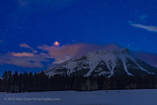
I managed to pull this one off, not just seeing the eclipse of the Moon, but getting a few photos.
The secret was in planning, using some helpful apps …
Because this eclipse was occurring before dawn for western North America the eclipsed Moon was going to be in the west, setting.
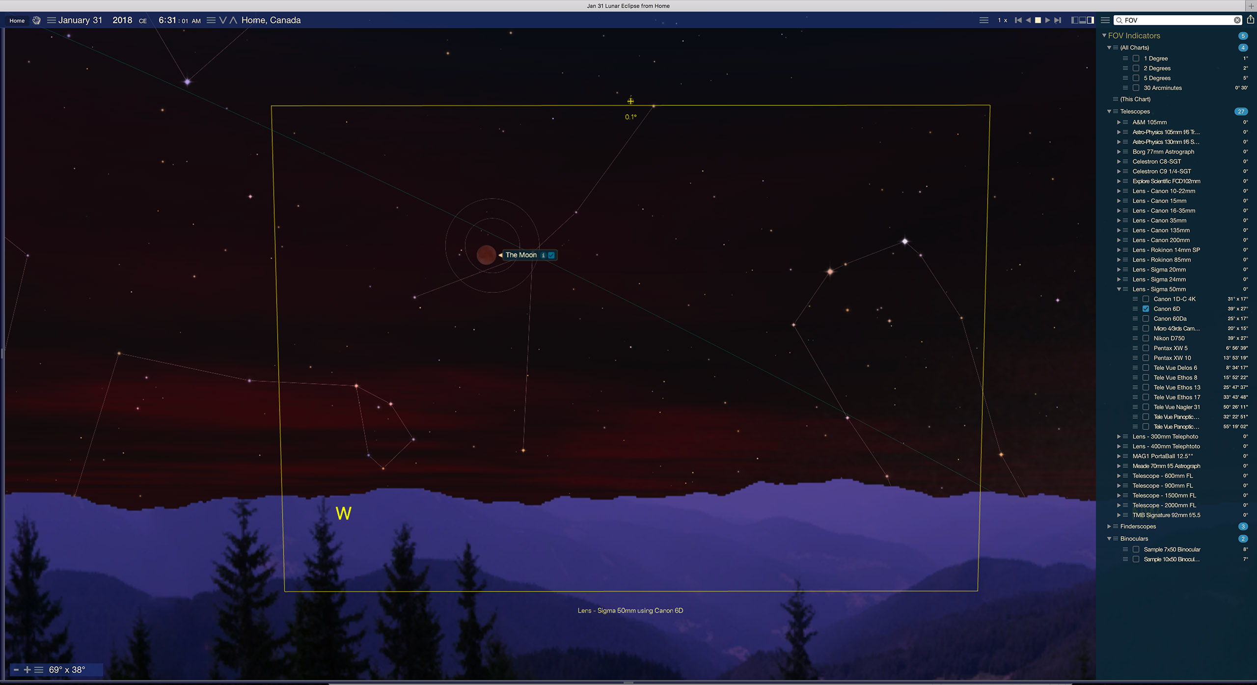
To plan any shoot the first app I turn to is the desktop planetarium program Starry Night™.
Shown above, the program simulates the eclipse with the correct timing, accurate appearance, and location in the sky at your site. You can set up indicators for the fields of various lenses, to help you pick a lens. The yellow box shows the field of view of a 50mm lens on my full-frame camera, essential information for framing the scene.
With that information in mind, the plan was to shoot the Moon over the Rocky Mountains, which lie along the western border of Alberta.
The original plan was a site in Banff on the Bow Valley Parkway looking west toward the peaks of the Divide.
But then the next critical information was the weather.
For that I turned to the website ClearDarkSky.com. It uses information from Environment Canada’s Astronomy forecasts and weather maps to predict the likelihood of clouds at your site. The day before the eclipse this is what it showed.

Not good! Home on the prairies was not an option. While Banff looked OK, the best prospects were from farther south in the Crowsnest Pass area of Alberta, as marked. So a chase was in order, involving a half-day drive south.
But what actual site was going to be useful? Where could I set up for the shot I wanted?
Time to break out another app, The Photographer’s Ephemeris. This is for desktop and mobile devices.
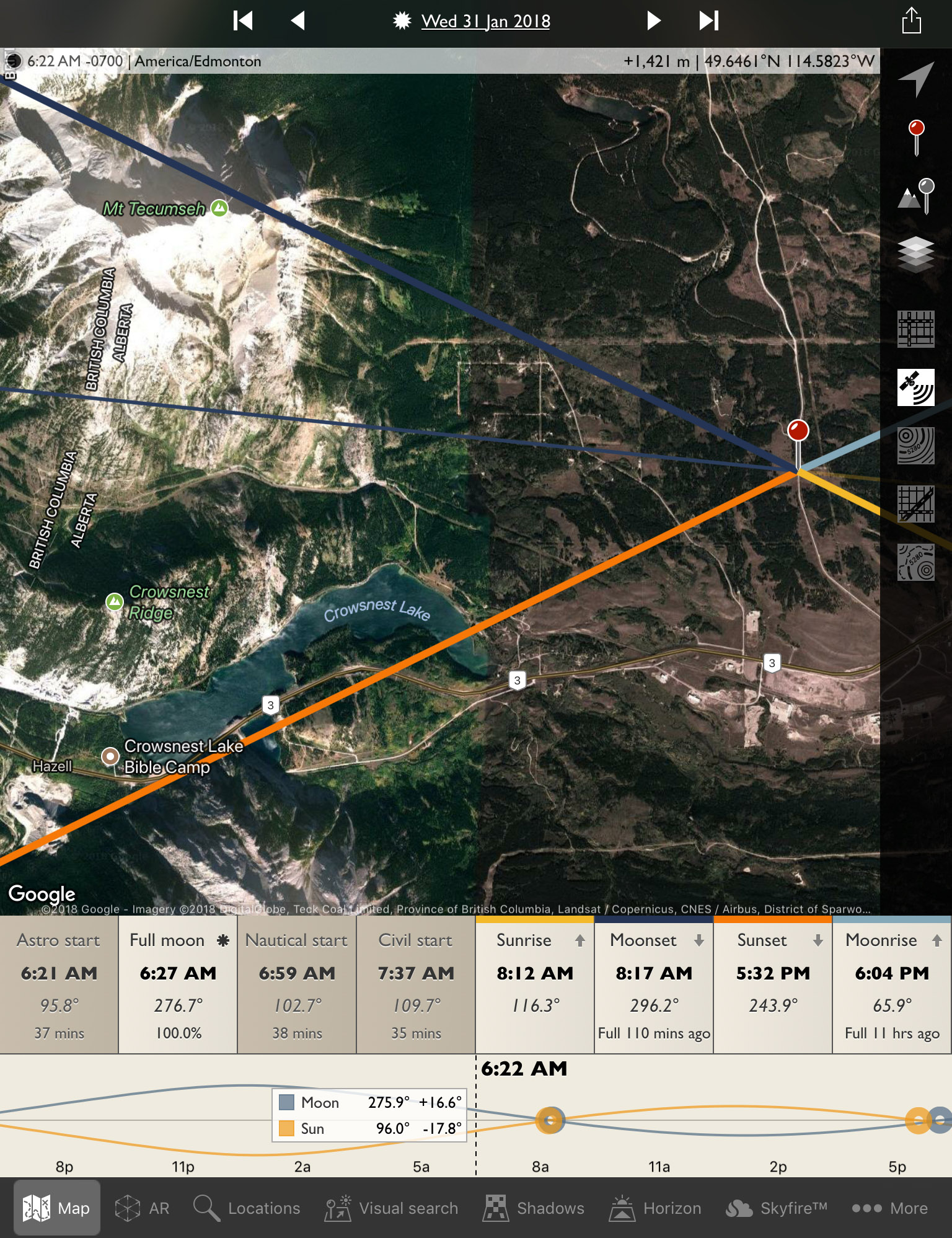
I needed a spot off a main highway but drivable to, and with no trees in the way. I did not know the area, but Allison Road looked like a possibility.
The TPE app shows the direction to the Sun and Moon to help plan images by day. And in its night mode it can show where the Milky Way is. Here, the thin blue line is showing the direction to the Moon during totality, showing it to the south of Mt. Tecumseh. I wanted the Moon over the mountains, but not behind a mountain!
With a possible site picked out, it was time to take a virtual drive with Google Earth.
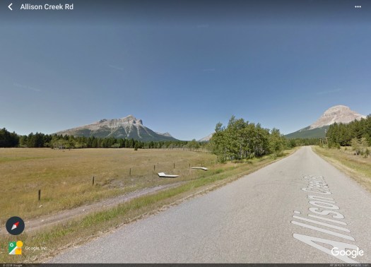
The background map TPE uses is from Google Earth. But the actual Google Earth app also offers the option of a Street View for many locations.
Above is its view from along Allison Road, on the nice summer day when the Google camera car made the drive. But at least this confirms there are no obstructions or ugly elements to spoil the scene, or trees to block the view.
But there’s nothing like being there to be sure. It looks a little different in winter!
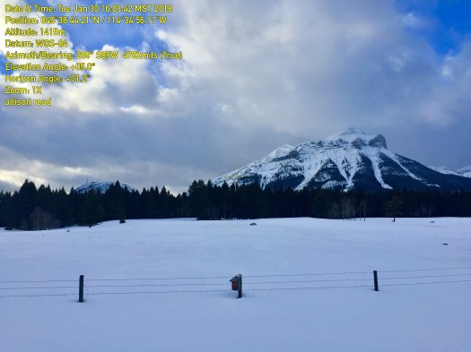
After driving down to the Crowsnest Pass the morning before, the first order of the day upon arrival was to go to the site before it got dark, to see if it was usable.
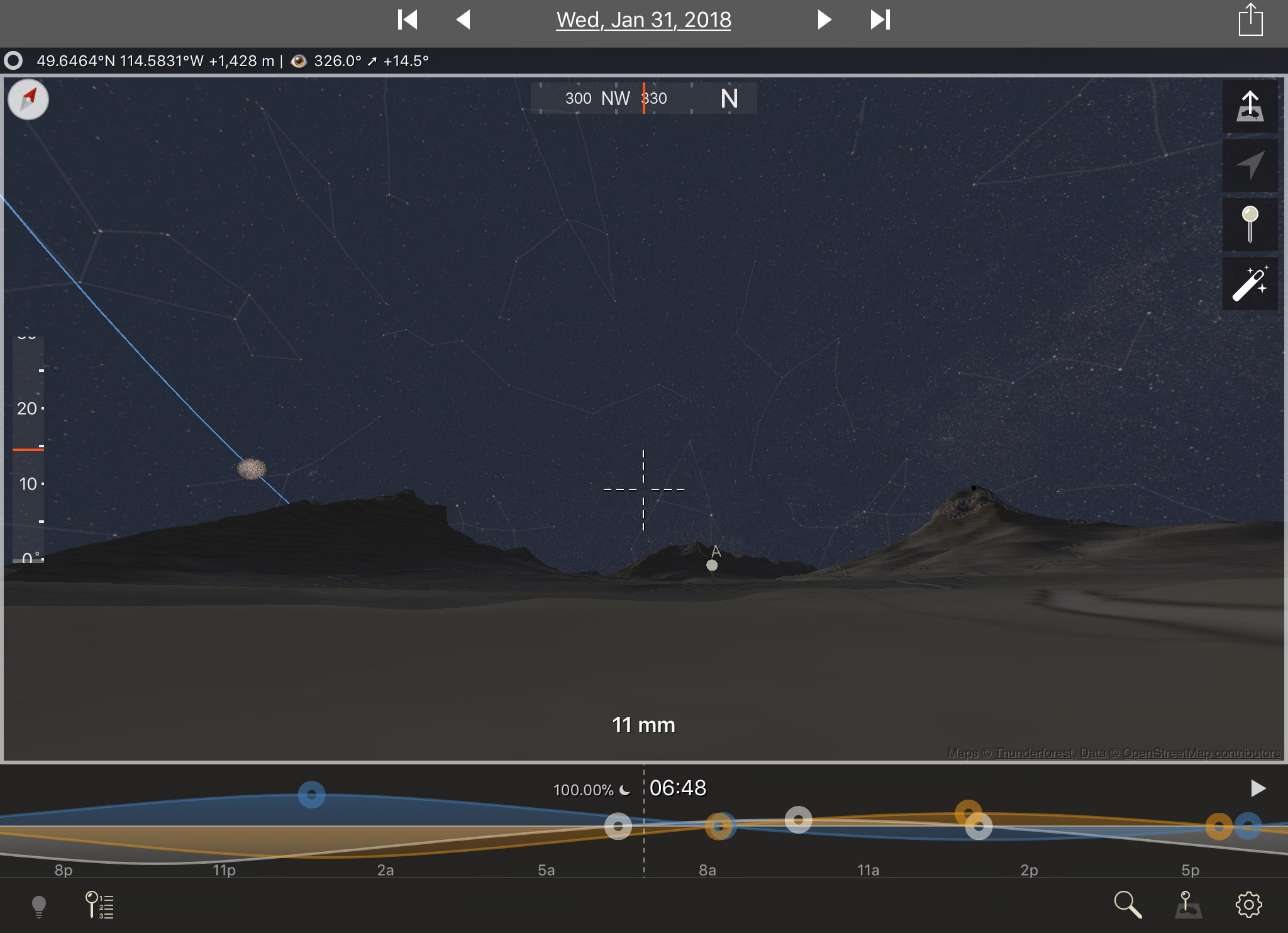
I used the mobile app Theodolite to take images (above) that superimpose the altitude and azimuth (direction) where the camera was aimed. It confirms the direction where the Moon will be is in open sky to the left of Tecumseh peak. And the on-site inspection shows I can park there!
All set?
There is one more new and very powerful app that provides another level of planning. From The Photographer’s Ephemeris, you can hand off your position to a companion mobile app (for iOS only) called TPE 3D …
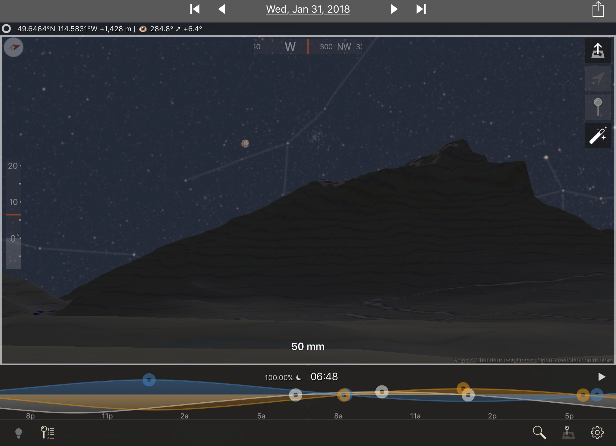
It provides elevation maps and places you on site, with the actual skyline around you drawn in. And with the Moon and stars in the sky at their correct positions.
While it doesn’t simulate the actual eclipse, it sure shows an accurate sky … and what you’ll frame with your lens with the actual skyline in place.
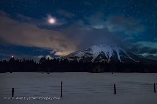
Compare the simulation, above, to the real thing, below:
Pretty amazing!
Zooming out with TPE 3D provides this preview of a panorama I hoped to take.
It shows Cassiopeia (the W of stars at right) over the iconic Crowsnest Mountain, and the stars of Gemini setting to the right of Tecumseh.
Here’s the real thing, in an even wider 180° view sweeping from south to north. Again, just as predicted!

Between the weather predictions – which proved spot on – and the geographical and astronomical planning apps – which were deadly accurate – we now have incredible tools to make it easier to plan the shot.
If only we could control the clouds! As it was, the Moon was in and out of clouds throughout the 70 minutes of totality. But I was happy to just get a look, let alone a photo.
The next total lunar eclipse is in six months, on July 27, 2018, but in an event visible only from the eastern hemisphere.
The next TLE for North America is a more convenient evening event on January 20, 2019. That will be another winter eclipse requiring careful planning!
Clear skies!
— Alan, February 1, 2018 / © 2018 Alan Dyer / AmazingSky.com
