Mount Kobau Nightscapes


Big Dipper Down the Road

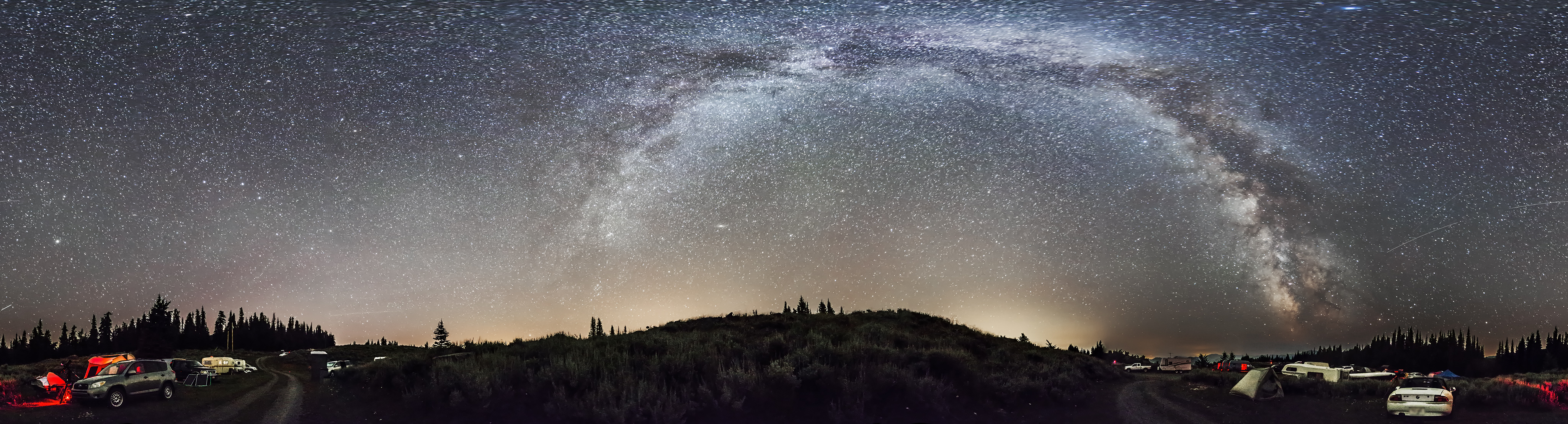
The pines and sagebrush landscape of the summit of Mount Kobau are illuminated by the light of just the stars and Milky Way.

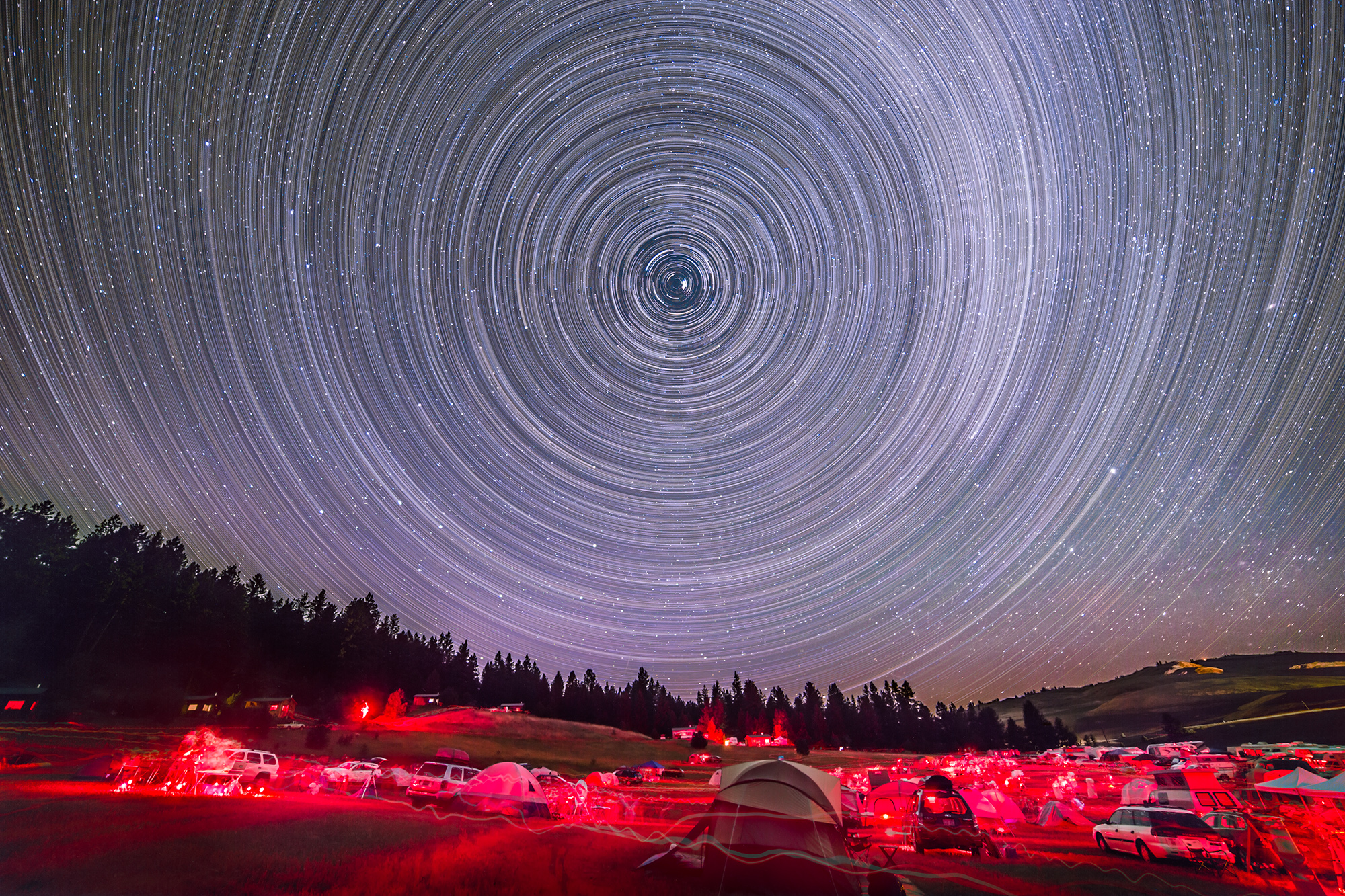
This collection of images from Monday night, July 28, captures the night sky above and the land below in classic “nightscapes.”

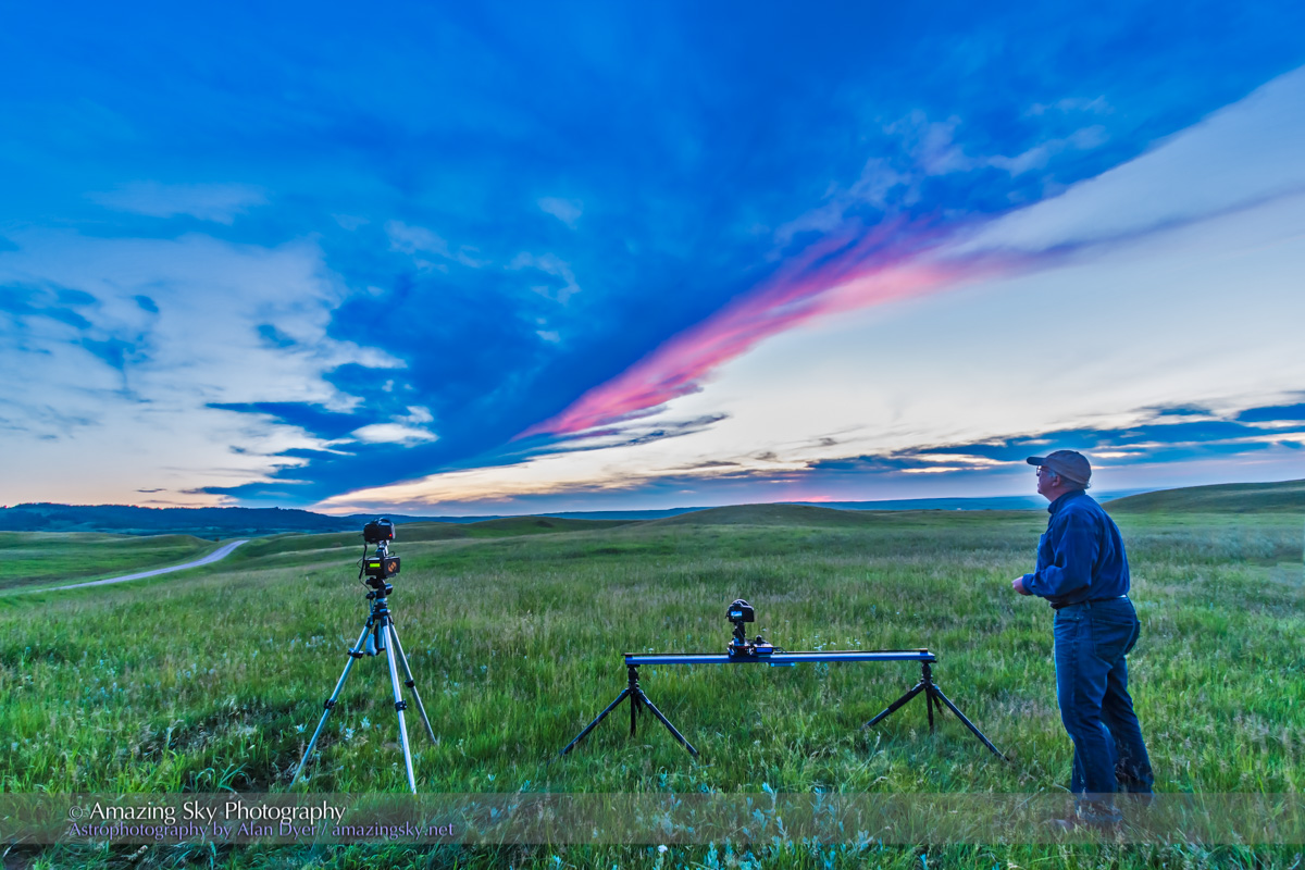
I took all of these with a camera on a static tripod, with no tracking system involved here. All are about 40-second exposures at ISO 3200 to 6400 with a fast 24mm lens at f/2.5 on a Canon 6D.

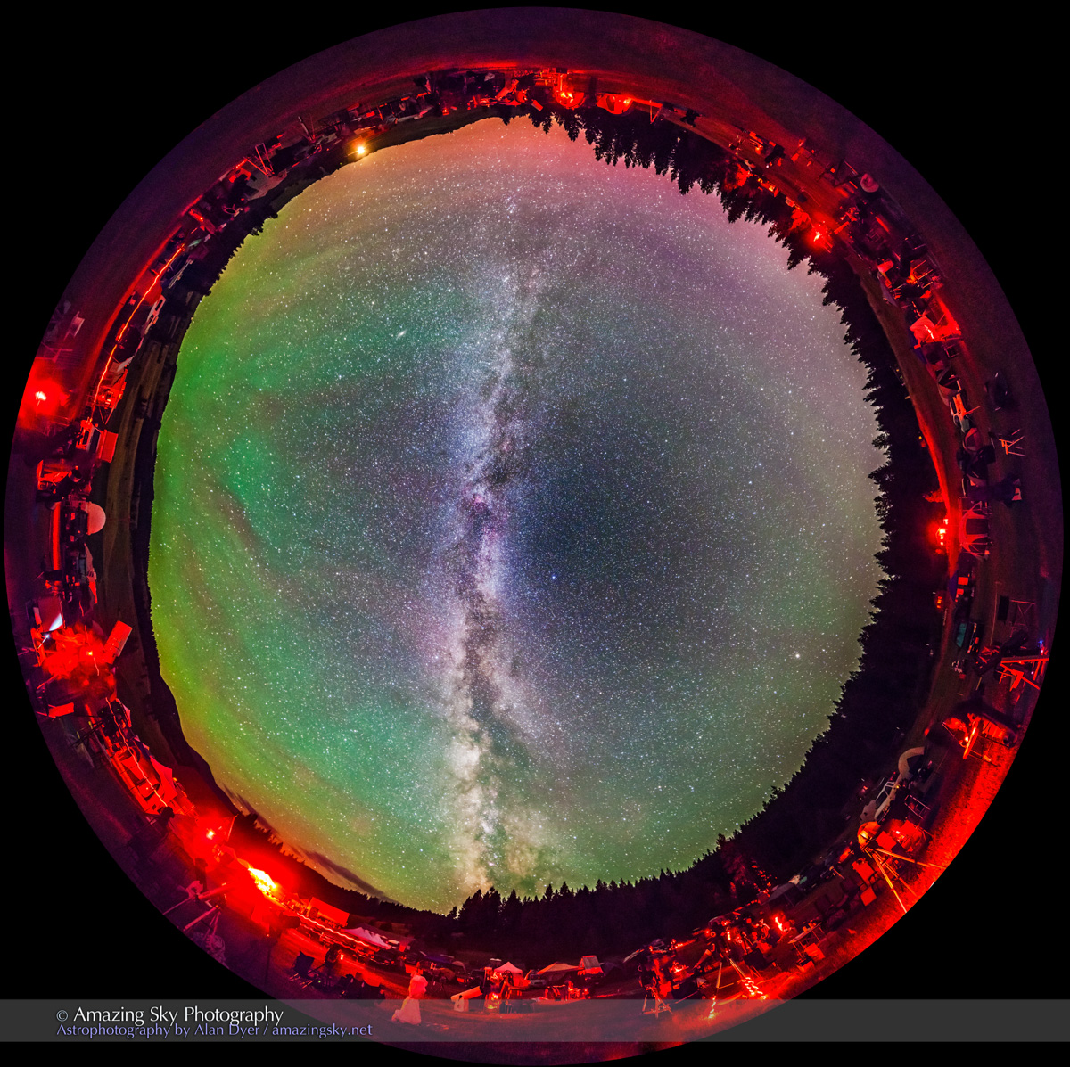
However, for the image above I composited two exposures: a shorter 40 second shot for the sky and a longer 1 minute 40 second shot for the ground. I used Photoshop’s Quick Selection tool to make a rough selection of the ground, then the Refine Mask and Smart Radius tool to refine the edge to precisely mask the sky separately from the ground, for individual processing.

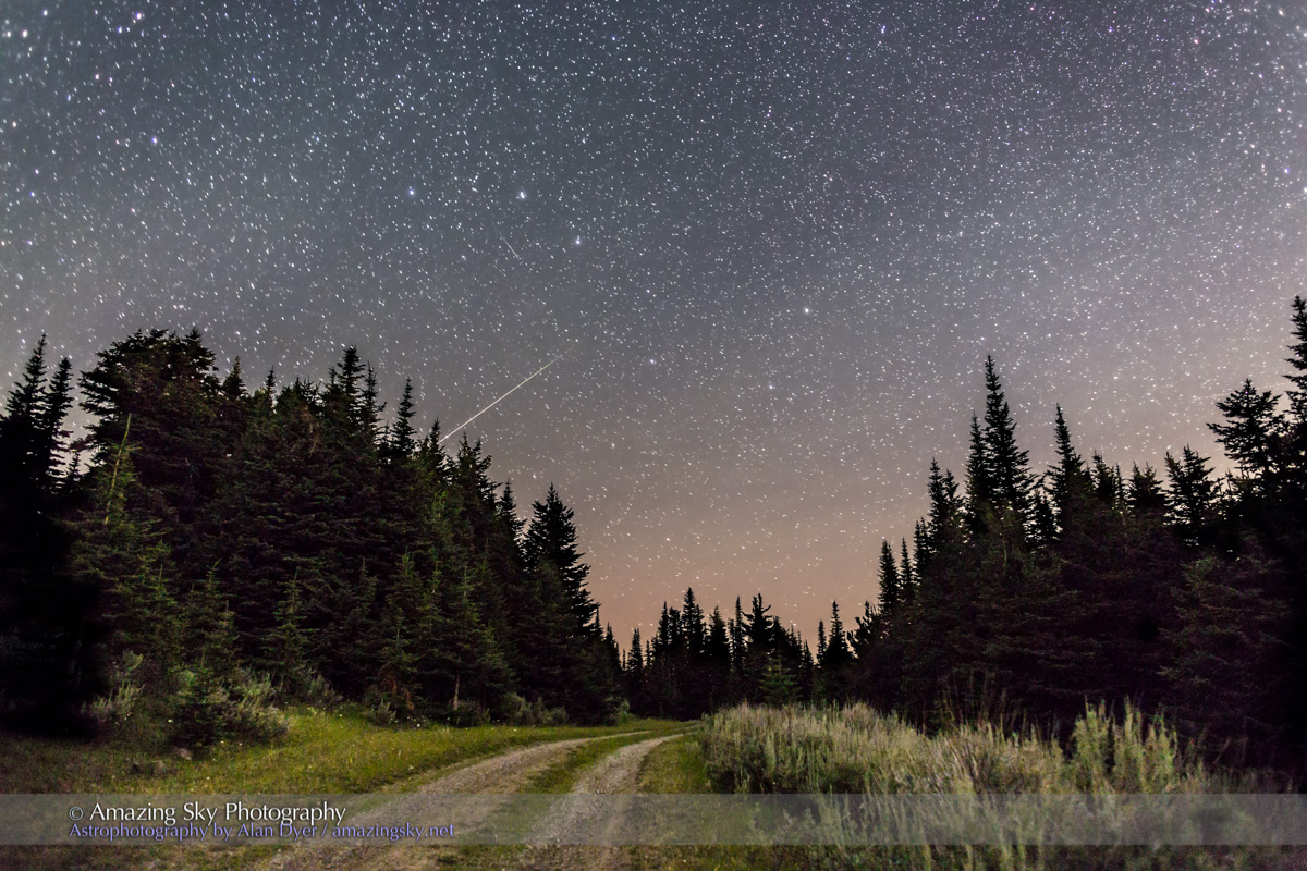
The top image shows the Big Dipper and a well-timed meteor, at the end of the summit road on Mt. Kobau, near Osoyoos, BC.

Big Dipper & Arcturus from Mt Kobau

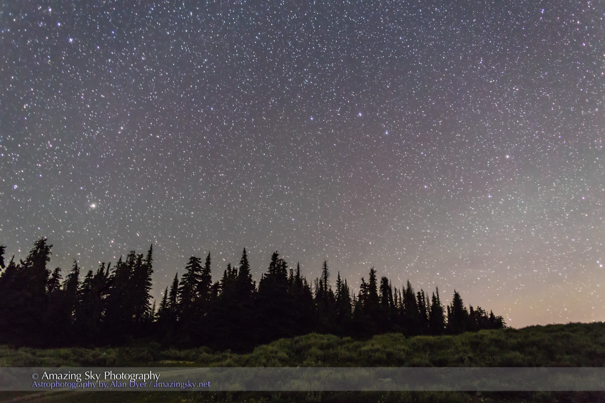
This image takes in the Big Dipper at right pointing down to Arcturus at left. I used Photoshop’s Content Aware Fill to neatly eliminate a power pole and wires.

Sagebrush and Stars

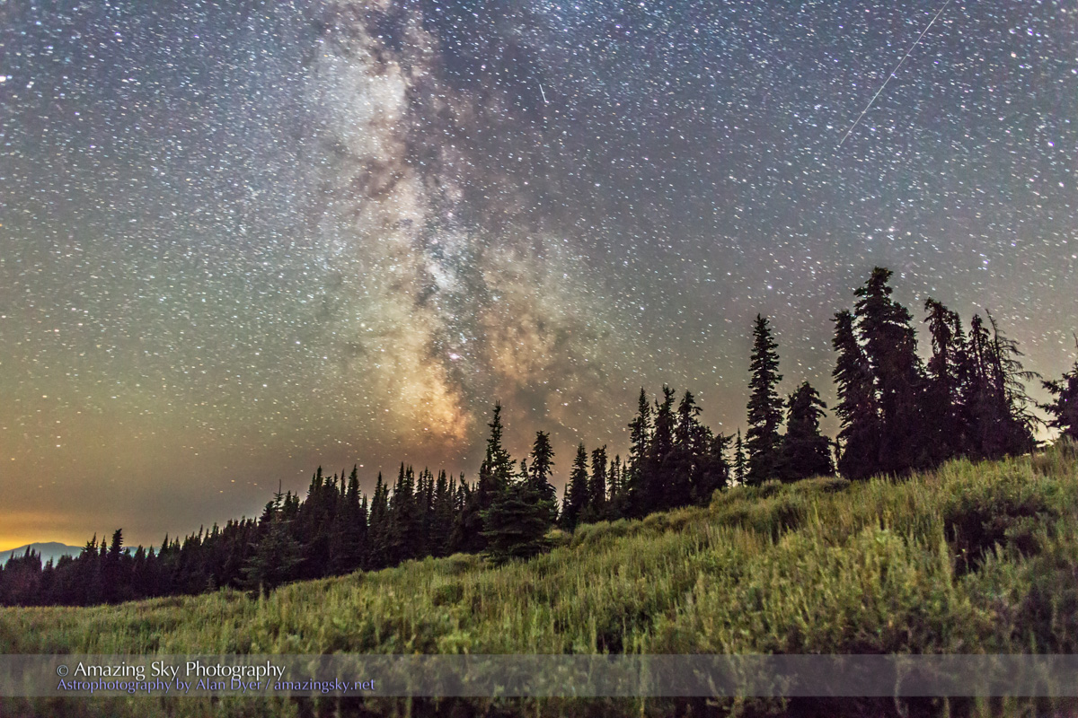
Looking southwest reveals the Milky Way above the sagebrush and pine trees. This is a single exposure, with the ground processed with Shadow detail recovery to bring out the starlit ground.

Pleiades Rising Down the Road

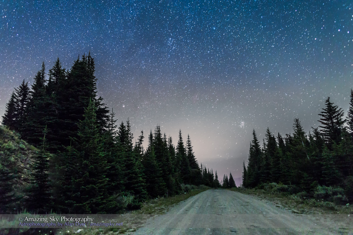
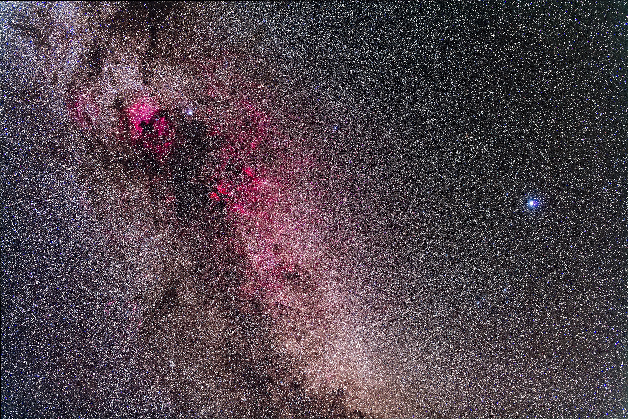
This image, taken about 2 a.m., records the Pleiades star cluster rising down the end of the summit road, with Capella at left. It is a dual-exposure composite: 40 seconds for the sky and 1m40s for the ground.

I gave a talk at this year’s Mt. Kobau Star Party on how to shoot these kinds of nightscapes, illustrated with some of these images shot on site the night before. Very nice!

– Alan, July 30, 2014 / © 2014 Alan Dyer


Mt Kobau Milky Way


Summer Milky Way from Mt Kobau

The Milky Way towers over the pine trees and sagebrush of Mt. Kobau in the South Okanagan, BC.

It’s been a fine two nights renewing friendships and seeing stars at the summit of Mount Kobau near Osoyoos. I’ve not been here for a dozen years but the timing worked out this year for me to visit the annual Mt. Kobau Star Party, the first star party I attended back in the 1980s.

It’s a rough road to the summit but the reward is a beautiful landscape and skyscape.

The main image above is from Monday night and takes in the Milky Way from horizon to zenith, from Sagittarius to Cygnus. I used a 15mm lens and Canon 5D MkII riding on a new Sky-Watcher Star Adventurer tracking unit, which worked beautifully.

Mt Kobau Milky Way Panorama #1

This image, similar to one I took a few nights ago at the Table Mountain Star Party, is a 360° panorama of the land and sky at the Kobau summit. It is a stitch of 8 segments, each 45-second exposures at ISO 6400 with the Canon 6D and 14mm Rokinon lens.

Unfortunately, it shows the light pollution glows from Osoyoos and Oliver that have grown over the last 3 decades and now impinge upon the Kobau skies.

Cygnus and Lyra (2014)

This image is a tracked closeup of the Cygnus and Lyra area of the Milky Way, taken with a 50mm lens and the 5D Mark II riding on the Star Adventurer for a stack of five 10-minute exposures. It is rich in the red nebulosity of the Cygnus spiral arm and takes in the field that the Kepler satellite stared at for 4 years looking for alien planets.

I’m heading home but the star party continues all week, building to the weekend when most people will be attending, under prospects of clear skies and warm weather.

– Alan, July 30, 2014 / © 2014 Alan Dyer


Swirling Stars at a Star Party


Table Mountain Star Trails-Circumpolar Elastic Effect

The stars of the northern sky swirl in circles around the North Star.

This is admittedly a fanciful effect but an attractive one. The above image records the rotating night sky as it spins around the north celestial pole near Polaris. I stacked 250 image to create this concentric star swirl.

To produce the image I used the excellent Advanced Stacker Actions from StarCircleAcademy, using the new version 14e actions. They include this novel “elastic” effect which produces trails with point-like stars at the beginning and end of the trails.

Table Mountain Star Party Star Trails #1

Another variation, the Short Comets effect, produced this image, with the stars turned into swirling comets.

I took the images for these composites at the Table Mountain Star Party near Oroville, Washington last week under superb skies. The same images that went into these still image stacks can be used to create time-lapse movies.

– Alan, July 29, 2014 / © 2014 Alan Dyer

Panoramas of the Summer Milky Way


Table Mountain Star Party Panorama #1 The Milky Way spans the sky on a summer night at a dark-sky star party.

What a fabulous weekend! For the last few nights I’ve enjoyed the skies and hospitality of the Table Mountain Star Party in northern Washington state, near Oroville, just south of the Canada-US border. The site is the Eden Valley Guest Ranch, under superbly dark skies.

About 300 people, mostly from Washington, enjoyed getting under the Milky Way.

As I wandered around the telescope field I heard all kinds of excited comments in the dark: “Wow, look at that!” “Hey, take a look at the Swan Nebula!” “Want to see the Veil Nebula?”

I was impressed with the great mix of ages and demographics at the TMSP – it wasn’t just “old timers.” There were young families, couples, teens, even a pair of grannies pulled in for a look at the starry sky!

Table Mountain Star Party Panorama #2

The summer Milky Way arches across the sky in these 360-degree “pans.”

But the other main feature is the green fingers of airglow rising out of the east (at left in the circular image above). Only the camera picked these up – the sky looked very dark to the eye. There’s even a faint magenta glow on the northern horizon (at top in the circular image) from aurora.

Both images capture the entire sky, in a panorama set I took using a 14mm Rokinon lens, shooting vertically for 8 segments at 45° spacings. Each frame was a 45-second exposure at f/2.8 and ISO 6400, on a standard tripod, no tracking.

I used PTGui software to stitch and blend the images, then Photoshop CC 2014 to finish them off.

The top image uses “equirectangular” projection; the bottom image “stereographic” projection for a fish-eye effect. Both take in the entire sky from horizon to horizon, plus a lot of ground, filled with red-lighted and happy observers.

– Alan, July 27, 2014 / © 2014 Alan Dyer


Rainbow at Blackfoot Crossing


Rainbow at Blackfoot Crossing #2

A low rainbow shines beneath a retreating thunderstorm at Blackfoot Crossing Historical Park.

On my way home from Waterton Lakes I drove through a thunderstorm, then watched it retreat and the Sun break through in the west. I was hoping for a rainbow in the east, and sure enough, one appeared.

With the Sun still high in the late afternoon sky, the rainbow was low, with just a small arc appearing above the horizon.

By good luck, I was passing the hilltop Blackfoot Crossing Historical Park, a beautiful museum interpreting the history of the Siksika Nation, and a great place to look out over the prairie.

These photos look down a line of rock cairns running from the interpretive centre to the hilltop cemetery in the distance, below the arc of the bow.

Rainbow at Blackfoot Crossing #1

This wider angle image gives the context, with the bow at the bottom of the thundercloud, and fresh blue sky above.

I love the mountains but it’s nice to be back home on the prairies where we can see the wide horizon.

– Alan, July 20, 2014 / © 2014 Alan Dyer

Wild Rose Twilight at Red Rock Canyon


Waterton Wild Rose Twilight

Evening light illuminates the peaks around Red Rock Canyon in Waterton Lakes National Park.

I took this image last evening as part of a time-lapse sequence, framing the wild roses in the foreground and the peaks of Mount Blakiston (at left) and Mount Anderson (at right) in the distance. The site is the popular Red Rock Canyon area of the Park.

The last rays of sunlight are hitting Blakiston.

That peak is named for Thomas Blakiston, the first scientific explorer to map the area of Waterton and the passes of the southern Canadian Rockies. Although at the time he was here in 1858, this was still British colonial territory separated from the United States by an ill-defined border running along the 49th parallel just south of this spot.

Blakiston was part of the British Palliser Expedition, led by John Palliser, whose mission was to survey the little-known region south of the South Saskatchewan River to assess its suitability for settlement.

Palliser concluded that the parched rain-shadow area of what is now southern Saskatchewan and Alberta was “desert, or semi-desert in character, which can never be expected to become occupied by settlers.” That area became known as the Palliser Triangle. Only extensive irrigation made settlement possible.

Blakiston was the expedition’s magnetical observer, taking readings of the Earth’s magnetic field strength and direction throughout the region. He disputed Palliser’s leadership and soon broke away from the expedition to conduct his own treks and compile his own reports. It was Blakiston who named the area after Charles Waterton, a famous British naturalist of the time. The region became a nationally-recognized park in 1895

— Alan, July 18, 2014 / © 2014 Alan Dyer


Sunset over Waterton Lakes


Waterton Lakes Sunset

The setting Sun lights the clouds over Upper Waterton Lake, Alberta.

Waterton Lakes National Park is certainly one of my favourite places. The scenery is wonderful and the town small and quiet. It has all the beauty of Banff with none of the retail sprawl and traffic jams.

I shot the scene above two evenings ago, July 15, from the viewpoint at the Prince of Wales Hotel. It overlooks Middle and Upper Waterton Lakes, the latter lighting up as it reflects the sunset clouds. This is a frame from a motion-control time-lapse.

Waterton Lakes Trees

Last night I shot a time-lapse from the lakeshore, looking through the windswept trees toward the south end of the Upper Lake, as the Milky Way begins to appear in the darkening twilight.

Lights from the campground illuminate the trees with just enough light to balance the foreground and sky. Sometimes you can make use of man-made light.

I’m here at Waterton to conduct some public programs Friday and Saturday night. Skies are clear but hazy with smoke and cirrus clouds. But the days and nights are warm and aren’t windy, a welcome treat in Waterton!

– Alan, July 17, 2014 / © 2014 Alan Dyer


Super Moonrise over Canola Field


Super Moonrise over Canola Field

The orange Full Moon – a hyped “super moon” – rises over a yellow field of canola.

What a colourful sky this was tonight – the pink Belt of Venus twilight band above the blue shadow of the Earth, above the yellow ripening canola.

And the orange Full Moon embedded in our planet’s shadow.

The onslaught of publicity about super moons this week – it seems we now have not one but several a year making them all a lot less super! – does serve one purpose: it gets people out looking at the Moon they might otherwise take for granted.

Supermoon or not, this confluence of colours can occur any time the Full Moon rises. But if you aren’t outside watching you miss it.

– Alan, July 12, 2014 / © 2014 Alan Dyer


Super Moonrise at Red Rock Coulee


Super Moonrise at Red Rock Coulee

The Full Moon rises over the sandstone formations of Red Rock Coulee, Alberta.

This was moonrise – a super Moonrise – on Friday, July 11, 2014.

Publicized as yet another “super moon,” this moonrise was certainly excellent for me, with superb skies at Red Rock Coulee in southern Alberta. There’s no way anyone would be able to detect the fact this Moon was a little closer and larger than most Full Moons of 2014. But it was still a fine sight.

Here, you see it sitting in the pink Belt of Venus fringing the dark blue band of Earth’s shadow rising in the east just after sunset. The already red rocks are lit by the warm light of the western twilight.

The main photo is an HDR stack of 6 exposures, to capture the range in brightness from bright sky to darker foreground.

Mars and Spica above Red Rock Coulee

This night, as it is for a week or so at mid-month, reddish Mars was sitting just above blue-white Spica in Virgo. They are visible here as a double star in the moonlit southwestern sky. Saturn is to the left. This is a single exposure.

It was another perfect night – warm, dry and bug free, for 3 hours of moonlight time-lapse shooting, as well as taking these still images.

– Alan, July 12, 2014 / © 2014 Alan Dyer


Sunset over the Lonely Log Cabin


Log Cabin at Sunset

The clouds paint the sky at sunset over a pioneer cabin in the Cypress Hills.

This is a scene the original resident of this cabin would have enjoyed – and painted.

This lonely log cabin in the Battle Creek valley was built by Robert David Symons, renowned as a rancher, naturalist, game warden, and painter, in the style of western artists such as Charlie Russell.

The cabin looks like it dates from the pioneer days of the first European settlement of the area, in the late 19th century. But Symons settled here and built this log cabin in 1939, during the time he worked as a game warden in the Hills, posted at the Battle Creek Ranger Station. He lived in the cabin for only three years before selling it to Albert and Sylvia Noble in 1942.

The Nobles expanded the cabin to accommodate their family. They lived here for 10 years, working a sawmill in the area.

Today the cabin is a scenic stop on the rough and often muddy Battle Creek Road that winds from the Alberta to the Saskatchewan side of Cypress Hills Interprovincial Park. Travelling it is like being back in the 1940s, when roads were no better than improved cart tracks.

Shooting Time-Lapses at Cypress Hills Log Cabin

I spent an evening here two nights ago on a perfect summer night, shooting the sunset and then the cabin scene by moonlight using time-lapse cameras and gear.

The main scene at top is a high dynamic range stack of 6 images to preserve details in the bright sky and dark foreground.

The self-portrait is a single shot taken by moonlight. Mars and Spica are just setting as a pair of stars over the hills across the valley.

It was a magical night in the Hills.

– Alan, July 11, 2014 / © 2014 Alan Dyer


Circling Stars Over the Open Range


Reesor Ranch Circumpolar Star Trails

The stars swirl in circles above the big sky country of the Canadian Prairies.

For these images I set the camera to take hundreds of images over the course of about 4 hours, then stacked about 100 frames for each of the composites. I stacked the images with the application StarStax

The result shows the stars circling the North Celestial Pole and Polaris in the northern sky. The top image is from earlier in the night when the Moon was still up lighting the landscape.

Reesor Ranch Circumpolar Star Trails v2

The image above is from late in the night, after moonset, and with the glow of dawn beginning to brighten the northern sky. Some low noctilucent clouds are also appearing on the horizon.

This was a beautiful night at Reesor Ranch in Saskatchewan, on the edge of Cypress Hills Interprovincial Park, on the Alberta-Saskatchewan border. I’ve just wrapping up a week of shooting here with clear nights every night but two. The hard drives are full!

– Alan, July 11, 2014 / © 2014 Alan Dyer


Wild Rose Sunset


Wild Rose Sunset

The sky lights up pink to match the wild roses in Cypress Hills.

Last night the twilight sky over the Cypress Hills was simply stunning. The clouds contrasted with the blues and pinks of twilight. On the way out to an evening shoot I stopped to take this image of the darkening sky colours behind the blooming wild roses, the floral emblem of Alberta.

In this photograph I’m looking east, opposite the sunset. The dark blue on the horizon is the shadow of the Earth rising. Above the shadow is a fringe of pink, the Belt of Venus, from red sunlight still lighting the upper atmosphere in that direction. Its colour nicely matches the pink roses – Earth and sky in colour coordination.

This is a high dynamic range stack of 6 exposures, to capture the bright sky and darker foreground in one image, to render the scene as the eye saw it but the camera could not, at least not with a single exposure.

– Alan, July 8, 2014 / © 2014 Alan Dyer


Moon on the Water


Reesor Lake Moon HDR

The Moon shines over the still waters of a prairie lake.

On Saturday, July 5, the Moon put on a super show in the twilight sky. The Moon was exactly at first quarter phase 90° from the Sun, and it shone between Mars and the star Spica, for a tidy 3-world conjunction in the evening sky.

For these shots I was at one of my favourite places for nightscape shooting, Reesor Lake in Cypress Hills Interprovincial Park. These are still shots taken with one camera while two others were shooting time lapses of the fall of night and the Moon moving over the lake.

Moon on Reesor Lake #5

Later in the evening, some photogenic cirrus clouds moved through the scene, nicely filling out the composition.

Moon on Reesor Lake #6

Here, you can see Mars to the right of the Moon and Spica to the left of the Moon. Below, on the water swim three white American pelicans that frequent the prairie lakes around here.

This was a perfect night. The anglers weren’t catching too much despite the fish leaping from the water every few seconds. But I managed to catch some nice photos and movies. It was a fine summer night to enjoy the sky.

– Alan, July 7, 2014 / © 2014 Alan Dyer


Sunset on the Range


Sunset on the Range

The setting Sun provided a fine light show on the open range of the Canadian Prairies.

This was the scene Friday evening, July 4, as the Sun lit up the clouds in the big sky of the Historic Reesor Ranch.

I’m here for a week of intensive shooting and writing. On the first night the setting Sun put on a fine show, captured in still images, like the high dynamic range composite above, and in time-lapses captured with the motion control gear below.

Reesor Ranch Sunset Shoot #4

When I took these shots I was likely right on the 105th meridian, the line of longitude that marks the boundary of Alberta and Saskatchewan. Either way, the land is expansive and stunning.

Just to the south the land rises to the Cypress Hills and the namesake provincial park where I’m spending most nights shooting stills and time-lapses. More to come this week I’m sure!

– Alan, July 7, 2014 / © 2014 Alan Dyer


Waxing Moon on the Water


Moon over Middle Lake HDRThe waxing crescent Moon shines over water at Bow Valley Provincial Park, Alberta.

What an excellent evening this was. On July 2 I was at a newly discovered spot, the Whitefish picnic area, in Bow Valley Provincial Park between Calgary and Canmore, Alberta.

I was there with colleagues doing a shoot for a promotional video for a project I’m involved with. But after the business shoot, I stuck around to take my own shots for time-lapse movies and still images.

In the scene above the Moon is reflected in the still waters of Middle Lake in the Park. It’s a high dynamic range stack of seven exposures.

Crescent Moon over the Bow River

Here, a little earlier in the evening is the scene on the banks of the Bow River, with the Moon over the swiftly flowing waters of the glacier-fed Bow. Its waters nourish much of southern Alberta, making farming, industry and life possible in an otherwise dry, rain-shadow climate.

Though a year ago its flood-swollen waters were bringing disaster to many people along the Bow.

Shooting at Bow Valley Park

This evening I shot motion-control time-lapses by the Bow, using some new gear that slowly pans or turns cameras during a time-lapse shoot. This is me playing with the new eMotimo controller, while the Dynamic Perception dolly does its thing below.

Lots of fun!

– Alan, July 4, 2014 / © 2014 Alan Dyer


%d bloggers like this: