Moon and Twilight Planets over the Bow River


Moon with Antares, Mars & Saturn over Bow River

The waxing Moon shines between Saturn and Mars over the waters of the Bow River.

It was a beautiful autumn evening for watching the twilight showing of the crescent Moon accompanied by Saturn (at right of centre) and the pairing of Mars (at left, above) with his rival red star, Antares in Scorpius (at left, below).

The river is the Bow, with its headwaters at Bow Glacier in Banff.

To shoot this scene I drove to the grounds of the Blackfoot Crossing Historical Park south of Cluny, Alberta to take advantage of its viewpoint overlooking the Bow River and the heart of the traditional Siksika First Nations tribal lands.

It was here, in the valley below, that Treaty Seven was signed between Chief Crowfoot and Colonel James Macleod in September 1877. Today, a beautiful interpretive centre sits on the hillside at the heart of Blackfoot country.

– Alan, September 28, 2014 / © 2014 Alan Dyer


Rainbow at Blackfoot Crossing


Rainbow at Blackfoot Crossing #2

A low rainbow shines beneath a retreating thunderstorm at Blackfoot Crossing Historical Park.

On my way home from Waterton Lakes I drove through a thunderstorm, then watched it retreat and the Sun break through in the west. I was hoping for a rainbow in the east, and sure enough, one appeared.

With the Sun still high in the late afternoon sky, the rainbow was low, with just a small arc appearing above the horizon.

By good luck, I was passing the hilltop Blackfoot Crossing Historical Park, a beautiful museum interpreting the history of the Siksika Nation, and a great place to look out over the prairie.

These photos look down a line of rock cairns running from the interpretive centre to the hilltop cemetery in the distance, below the arc of the bow.

Rainbow at Blackfoot Crossing #1

This wider angle image gives the context, with the bow at the bottom of the thundercloud, and fresh blue sky above.

I love the mountains but it’s nice to be back home on the prairies where we can see the wide horizon.

– Alan, July 20, 2014 / © 2014 Alan Dyer

Floodwaters at Bow River Crossing


SIksika Nation and Bow River Flood Panorama #3

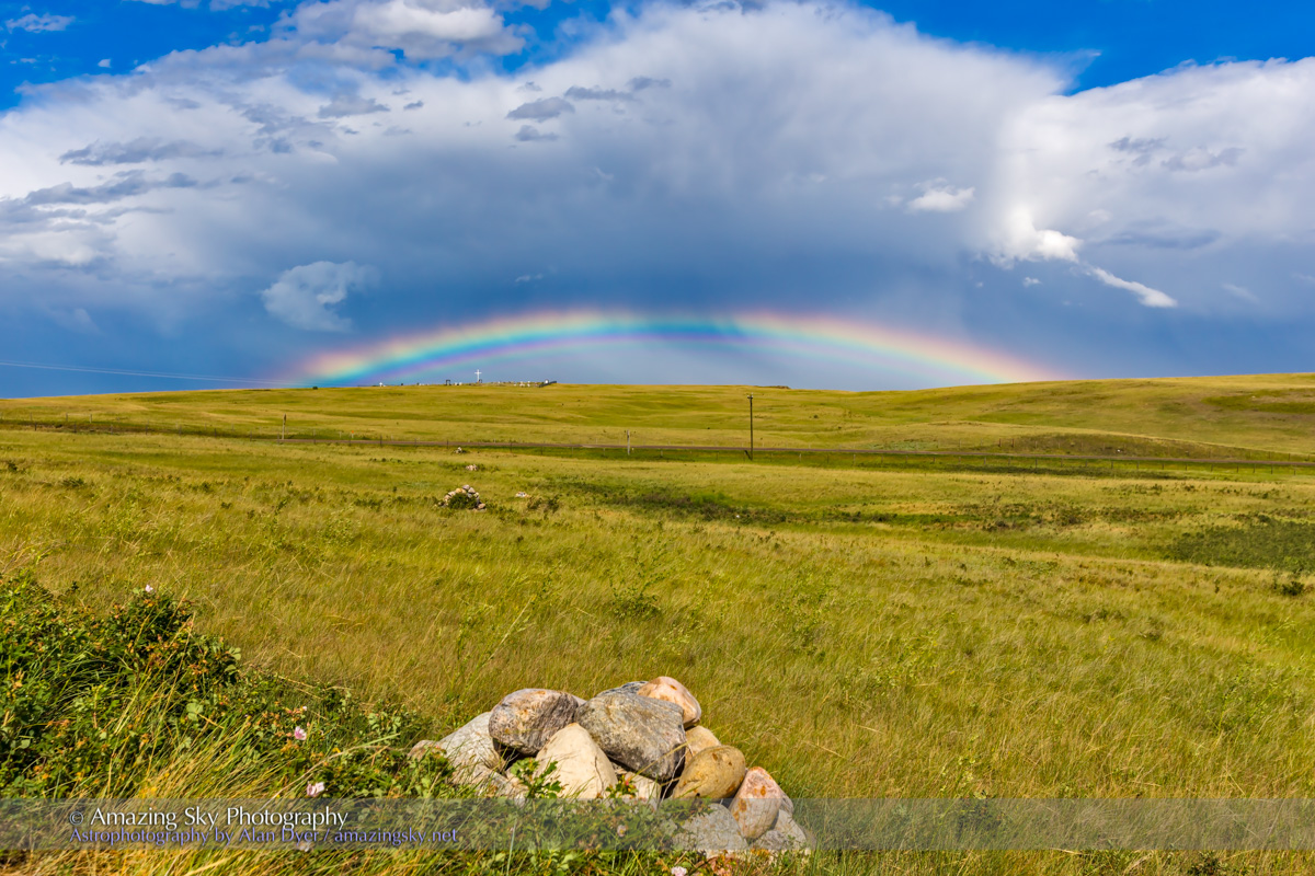
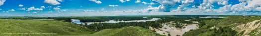
This is not a picture of the amazing sky but a document of what the sky can do when it decides to be merciless.

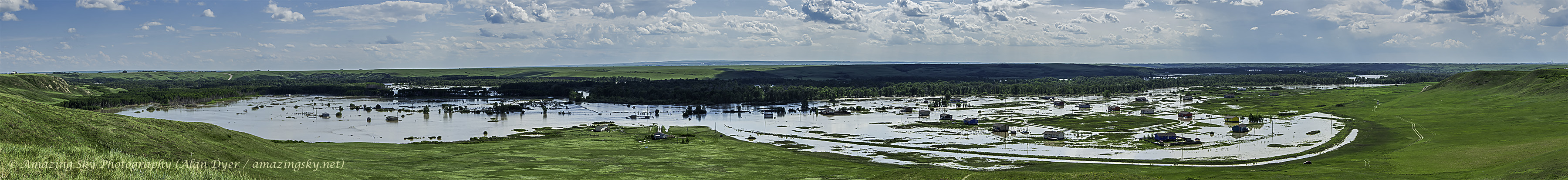
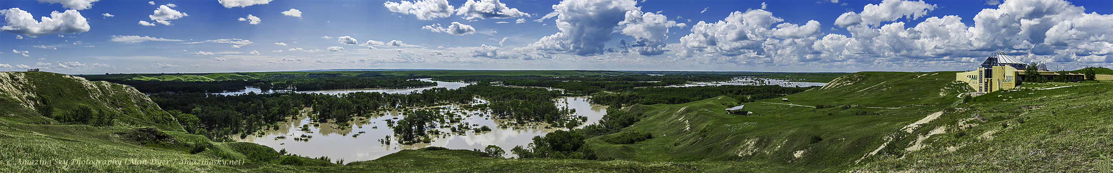
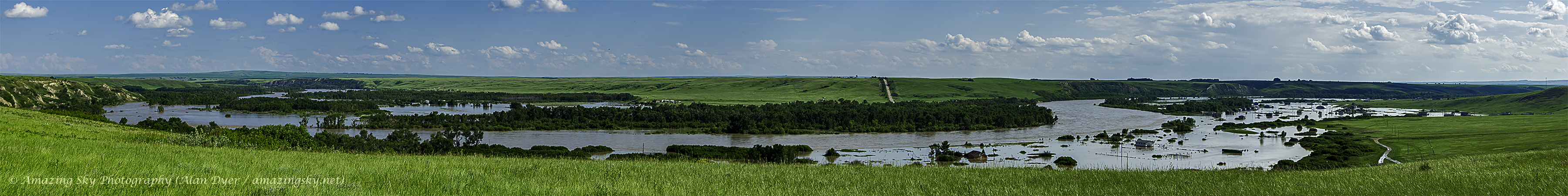
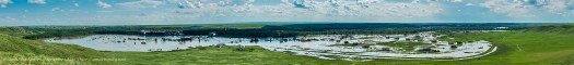
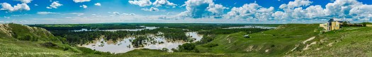
No one has seen anything like this in living memory, with homes under water and the river swollen to a lake engulfing the Bow River Valley.

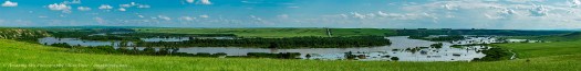
These panoramas depict the heart of the Siksika First Nation, part of the Blackfoot Confederacy. It was in this valley, where the Blackfoot had traditionally held their summer camps, that Treaty 7 was signed in 1877 between Chief Crowfoot and James Macleod of the NWMP. The history of the area is presented at the beautiful Blackfoot Crossing Historical Park interpretive centre, shown in the image below. We’ve held several popular public stargazing sessions there. It was closed today, ironically due to a lack of safe water.

SIksika Nation and Bow River Flood Panorama #1

It was here at this spot in the Bow River Valley that nomadic hunters could easily cross the river. Up to this weekend a bridge, seen in the distance in the image below, had allowed modern travellers to make the crossing. But no more. The bridge is closed and may never reopen, until it is rebuilt. Today, water was roaring just below the bridge deck. And waters have receded in the last 24 hours.

SIksika Nation and Bow River Flood Panorama #2

There is some fear that a ferry downstream, the Crowfoot Ferry, one of the last river ferries in Alberta, might break loose and crash into the Bassano Dam.

Dozens of homes are underwater and hundreds of people displaced to evacuation shelters. The water came up so fast many people had just minutes to get out.

SIksika Nation and Bow River Flood Panorama #4

Those I spoke to today, including one 68-year-old resident, said they have never seen the Bow flood as bad as this. The high waters, having breached the Carseland Dam upstream from here, are now heading downstream to fill the Bassano Dam and flood the lower Bow and South Saskatchewan River through Medicine Hat. As those upstream clean up, those downstream prepare for the onslaught of water.

– Alan, June 23, 2013 / © 2013 Alan Dyer

%d bloggers like this: